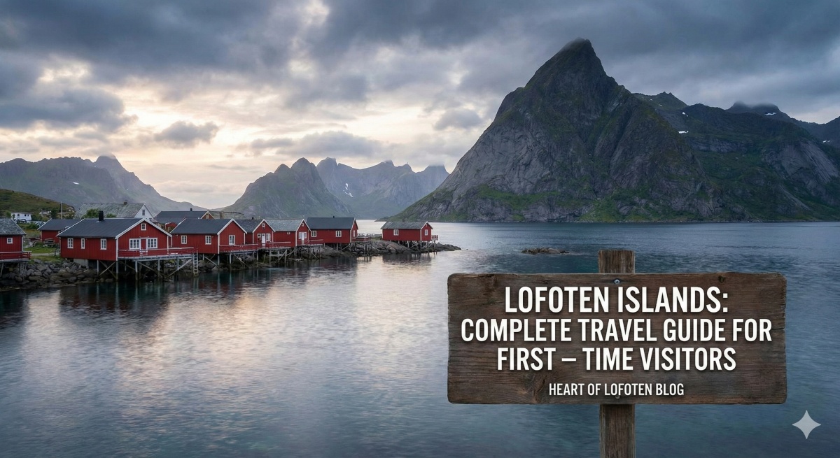
Many travelers first discover Norway through dramatic fjords or northern lights photos. Then a name appears again and again: the Lofoten Islands.
But before planning a trip, one common question arises:
Where are the Lofoten Islands?
Understanding the location of Lofoten Islands helps you understand why they feel so different from anywhere else in Europe. Geography shapes everything here — the light, the weather, the fishing culture, and the quiet rhythm of life.
Let’s explore where Lofoten is located, what makes its geography special, and why this remote Arctic archipelago is worth discovering.
Where Are the Exact Geographic Location of the Lofoten Islands?
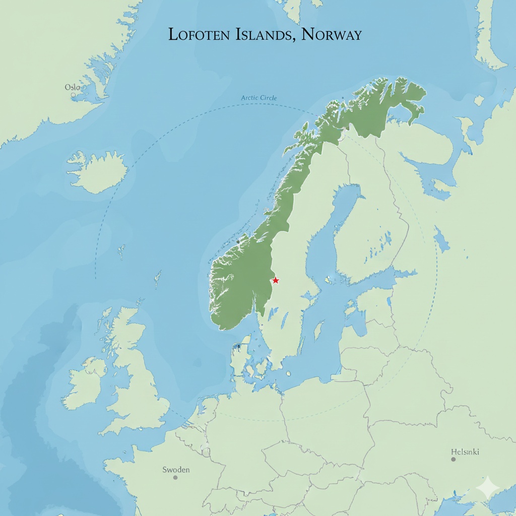
The Lofoten Islands are located in northern Norway, above the Arctic Circle, in the county of Nordland.
The Lofoten Islands are located in northern Norway, in Nordland county, above the Arctic Circle at approximately 68° to 69° North latitude. The archipelago extends westward into the Norwegian Sea and lies roughly 1,000 kilometers (620 miles) north of Oslo.
Lofoten is positioned between the Norwegian mainland and the open North Atlantic, forming part of Norway’s dramatic northern coastline. The islands are connected by bridges and the E10 European route, making them accessible despite their remote Arctic location.
More precisely:
-
Around 200 kilometers north of the Arctic Circle
-
West of mainland Norway
-
Facing the Norwegian Sea
-
Connected by bridges and scenic roads
Although Lofoten sits at the same latitude as parts of Greenland and northern Alaska, the climate is surprisingly milder thanks to the Gulf Stream.
This Arctic location is what creates the region’s most famous natural phenomena:
-
Midnight sun in summer
-
Northern lights in winter
-
Long blue twilight during polar night
The remote location of Lofoten is not a drawback — it’s the reason travelers come.
Lofoten Islands Coordinates
The approximate central coordinates of the Lofoten Islands are:
Latitude: 68.2° N
Longitude: 13.5° E
These coordinates place Lofoten well above the Arctic Circle, which lies at 66.5° N. Despite this high latitude, the islands experience a relatively mild climate due to the warming effect of the Gulf Stream.
Lofoten Islands Map Explained
When looking at a map, the Lofoten Islands appear as a dramatic chain of peaks stretching into the ocean.
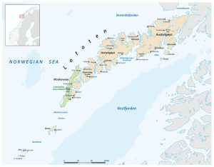
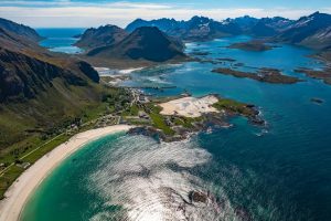
The archipelago includes several main islands:
-
Austvågøya
-
Vestvågøya
-
Flakstadøya
-
Moskenesøya
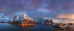
Key towns such as Svolvær, Reine, and Leknes are located along the main road (E10), which connects the islands.
The map reveals something important: Lofoten is not a single island, but a connected chain, allowing travelers to explore easily by car.
Understanding the map also helps you plan:
-
Distances are short but scenic
-
Weather can change quickly
-
Mountain roads require slow driving
The geography invites slow travel.
Geography and Landscape of Lofoten
The first thing most visitors notice is the dramatic landscape.
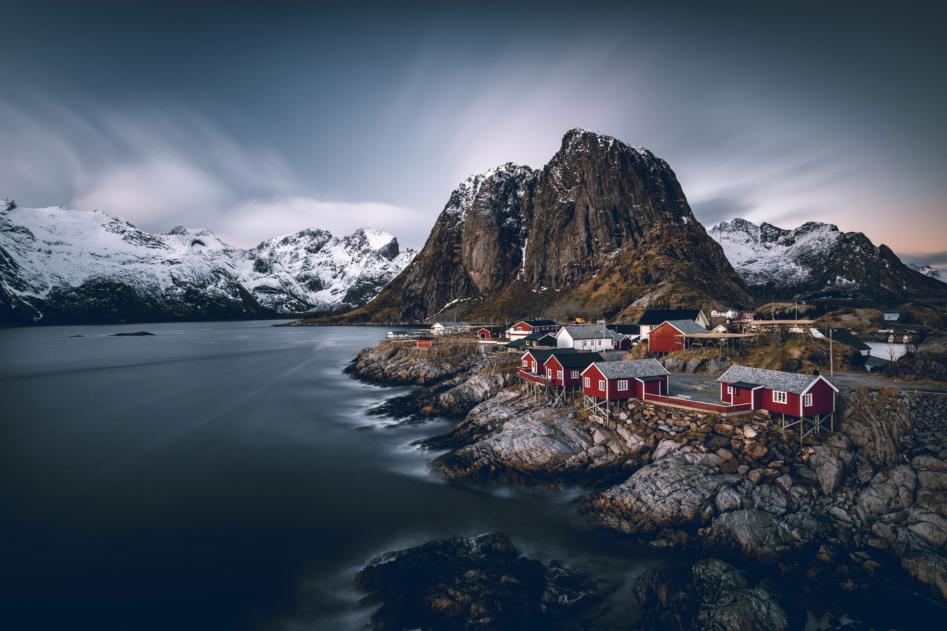
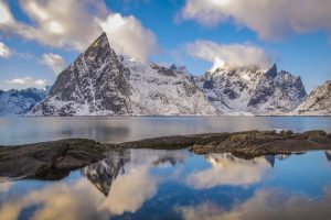
Sharp mountains rise directly from the sea. Small fishing villages sit on narrow strips of land between fjords and peaks. White sandy beaches appear unexpectedly in the Arctic.
This landscape exists because of ancient geological processes:
-
Glacial erosion shaped deep fjords
-
Tectonic uplift formed steep peaks
-
The ocean carved smooth coastal lines
The result is a rare combination of:
-
Alpine mountains
-
Arctic coastline
-
Open ocean
-
Traditional fishing settlements
How Far North Are the Lofoten Islands?
The Lofoten Islands are located at the same latitude as parts of northern Alaska, central Greenland, and Siberia. However, unlike those regions, Lofoten remains ice-free year-round due to warm ocean currents.
This unusual geographic contrast is one of the reasons the location of Lofoten Islands is considered unique worldwide.
Few places in the world offer such compact and intense scenery.
The geography influences daily life as well. Fishing has been central here for centuries, particularly cod fishing in winter.
Lofoten’s location between mountains and sea defines everything — from architecture to cuisine.
Lofoten Within Northern Norway
Lofoten forms part of Northern Norway and lies southwest of Tromsø and west of Narvik. The archipelago includes major islands such as Austvågøya, Vestvågøya, Flakstadøya, and Moskenesøya.
The main settlements include Svolvær, Leknes, and Reine, which are connected by the scenic E10 highway that runs through the entire island chain.
Why the Location Makes Lofoten Unique
So why does the location of Lofoten Islands matter so much?
Because few places combine:
-
Arctic latitude
-
Accessible infrastructure
-
Mild coastal climate
-
Authentic fishing culture
-
Dramatic vertical landscapes
Unlike more remote Arctic destinations, Lofoten is reachable — yet still feels wild.
Its position above the Arctic Circle creates extreme light conditions:
-
24-hour daylight in summer
-
Deep winter twilight
-
Frequent aurora activity
At the same time, thanks to ocean currents, temperatures are more moderate than many expect.
This combination of remoteness and accessibility is rare.
The Lofoten Islands are composed of some of the oldest rock formations in Europe, dating back nearly three billion years. Glacial activity during the Ice Age carved steep fjords and sharp peaks, creating mountains that rise directly from sea level.
This combination of ancient bedrock, glacial shaping, and Arctic coastal exposure makes Lofoten one of the most visually dramatic locations in Scandinavia.
How to Reach the Lofoten Islands
Understanding where Lofoten is also means understanding how to get there.
Most visitors travel via:
-
Flights to Bodø followed by a ferry
-
Direct flights to Svolvær
-
Scenic road trips from northern Norway
The journey itself becomes part of the experience. Seeing the mountains rise from the sea as you approach is unforgettable.
Discover Lofoten: More Than a Location
When people search “where are the Lofoten Islands”, they often expect a simple geographic answer.
But the location explains more than coordinates.
It explains:
-
The rhythm of fishing villages
-
The quiet roads
-
The light that photographers chase
-
The silence between mountains
Lofoten is not just a dot on the map. It is a place shaped by sea, wind, and time.
And once you understand where it is, you begin to understand why so many travelers return.
Frequently Asked Questions About the Location of the Lofoten Islands
Are the Lofoten Islands in the Arctic Circle?
Yes. The Lofoten Islands are located above the Arctic Circle at approximately 68° to 69° North latitude.
In which country are the Lofoten Islands located?
The Lofoten Islands are located in Norway, specifically in Nordland county in Northern Norway.
How far are the Lofoten Islands from Oslo?
The Lofoten Islands are approximately 1,000 kilometers (620 miles) north of Oslo.
What ocean are the Lofoten Islands in?
The islands extend into the Norwegian Sea, which is part of the North Atlantic Ocean.
Are the Lofoten Islands part of mainland Norway?
No. Lofoten is an archipelago made up of several islands, but it is connected to mainland Norway by bridges and roads.
Why is Lofoten warmer than other Arctic regions?
Lofoten is warmer than many Arctic regions because of the Gulf Stream, a warm ocean current that moderates temperatures along Norway’s coast.
What cities are near the Lofoten Islands?
Nearby mainland cities include Bodø and Narvik, while Tromsø lies further northeast.
Can you see the Northern Lights in Lofoten?
Yes. Because the islands are above the Arctic Circle, they are an excellent location to observe the Northern Lights during winter.
Now you know the answer to where are the Lofoten Islands — but more importantly, you understand why their location matters.
Perched above the Arctic Circle, surrounded by ocean and mountains, Lofoten offers a rare balance between wild nature and human presence.
If you are ready to go beyond maps and coordinates, it may be time to truly discover Lofoten.
If you are planning your first visit and want practical details about seasons, transportation and itineraries, explore our complete lofoten islands travel guide for in-depth planning advice.